Trip date: June 3, 2023
Duration: 5.5hr
Distance: 12km
Elevation gain: 1300m
For the first weekend of June, I was at Nipika with my family. We all have different interests and move at different speeds, so we all made our own plans for Saturday. I knew I wanted to take advantage of how far up the road I already was and do a scramble on this side of the divide! But I also wanted something relatively easy, so I could still hold a conversation with my family in the evening! I settled on Mt Soderholm. Vern’s report made it seem very quick and straightforward. My main concern was whether my vehicle would make it up the Miller Pass Road. It sounded like the road had some pretty rough spots and while my Forester has more clearance than the old Impreza did, it’s still quite a bit lower than his truck! On the other hand, I’ve seen how he drives on rough roads and let’s just say that we don’t treat our vehicles the same way! I had my bike in the car just in case I couldn’t drive as far as I’d like. My second concern was whether the massive avalanche slope that he and Phil used would have any helpful snow in it! Things are DRY out there!
Branching off from the Mitchell River Road, the Cross River Road was much smaller but in good condition. The Miller Pass Road was no longer signed, but it looked only a touch less used than the Cross River Road. It was quite obvious when I got to the part of the road Vern’s report had warned about. There were some deep ruts running down the road, with bowling ball sized rocks that had fallen from the slope above littering the road. But carefully crawling in first gear made it pretty easy to avoid the obstacles and I was able to make it through without any bumps or scrapes. I continued up the road to the crossing of the creek that drains the SW side of Soderholm. This was as far as I planned to drive, but it was interesting to note that the bridge is out over this creek! I parked and continued up the spur road beside the creek on foot.

After about a kilometer on the spur road, it became much more overgrown. The willows were pretty tall and visibility was limited, I was doing a lot of bear calls! There were actually a couple spots where I spotted bear tracks in the moss. I’m not sure how long moss holds a defined print like that, but it can’t be long! Another ~1.2km got me to the spot where I turned left and got onto the very convenient trail that goes up the valley. I had Vern’s GPS track to confirm, but it actually seemed pretty natural to follow the trail instead of staying on the roadbed. A couple small rocks placed across the road kinda pushed me to the left and made the trail easy to spot. The trail got onto another roadbed and headed west (backwards) ever so briefly, and then switchbacked east again (still on old road). It stayed on the old road to the end of the cutblock, then continued through mature forest to a large avalanche path. I lost the trail there, and continued up the valley on a narrow strip of open ground the forest and the creek.

I got on a bit of an animal trail and followed bear tracks up through the headwall on the right side. Above the headwall was the massive avalanche gully that I would take all the way to the ridge high above. I could hear water in the gully and I was really hoping that there would still be enough snow remaining to be useful… And there was! I only had microspikes with me, but they worked well enough for marching straight up the gully.

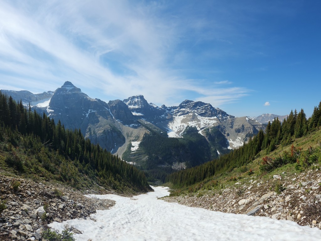
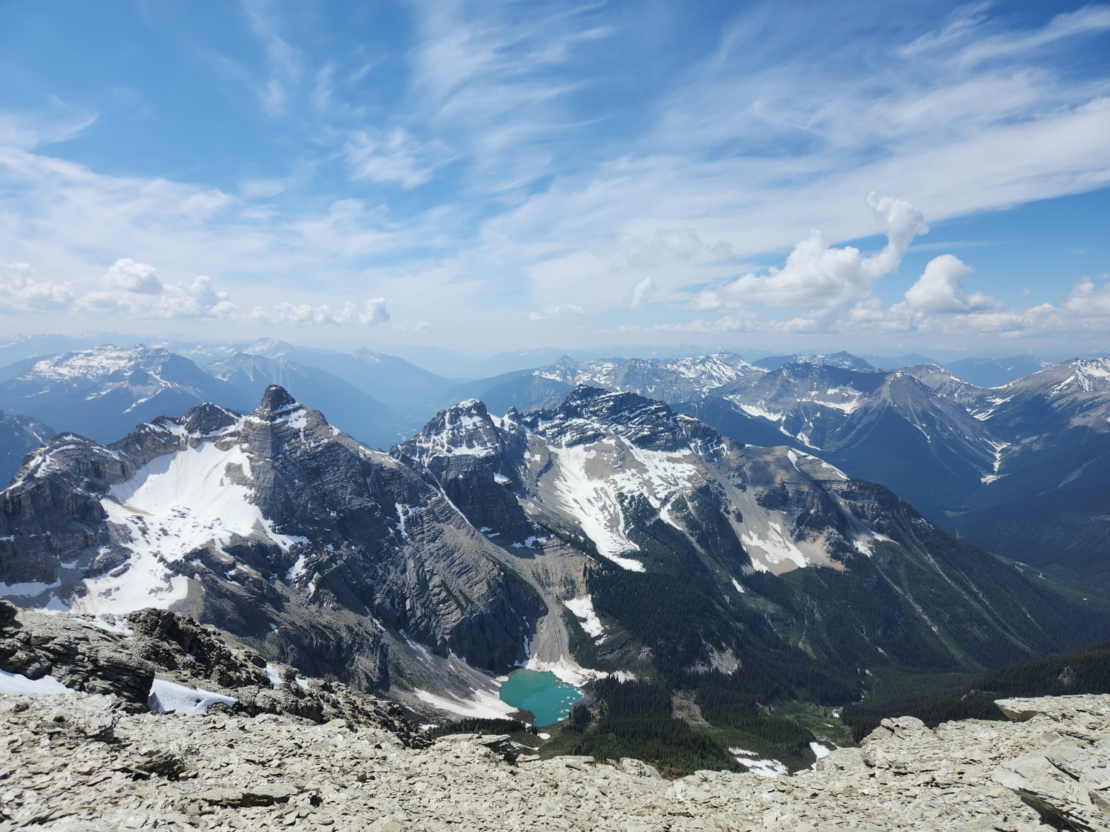
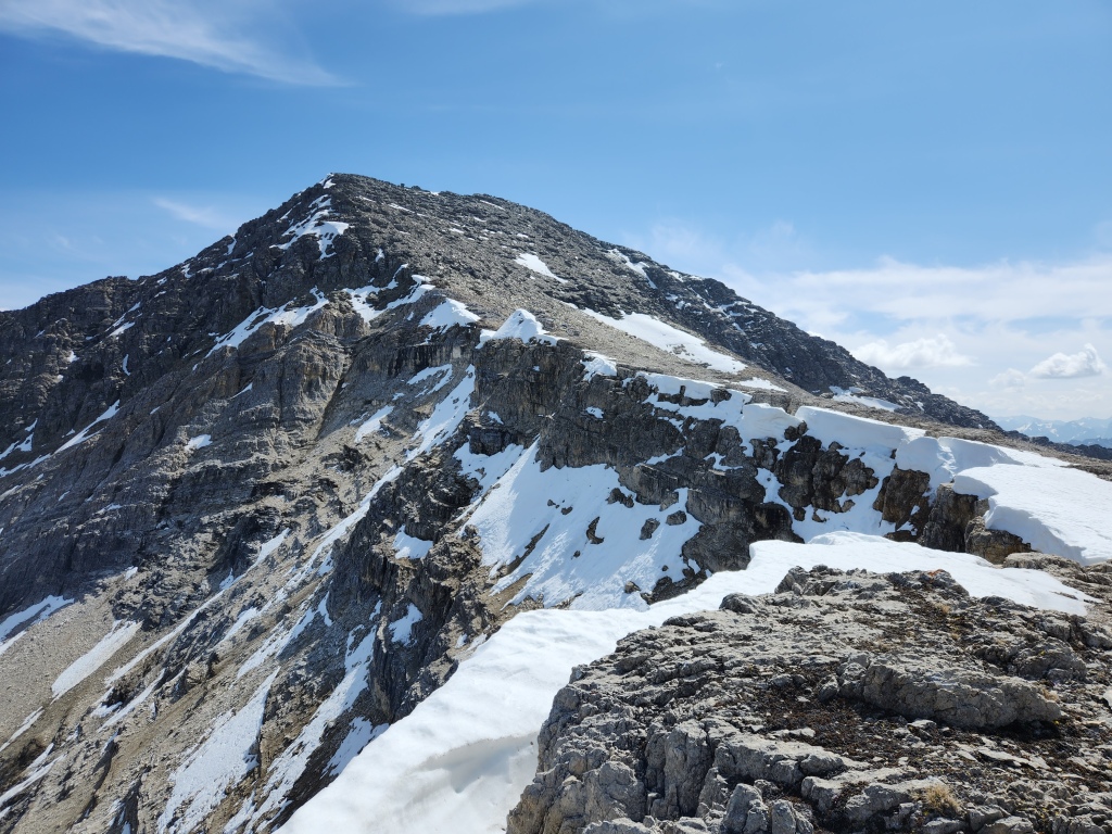
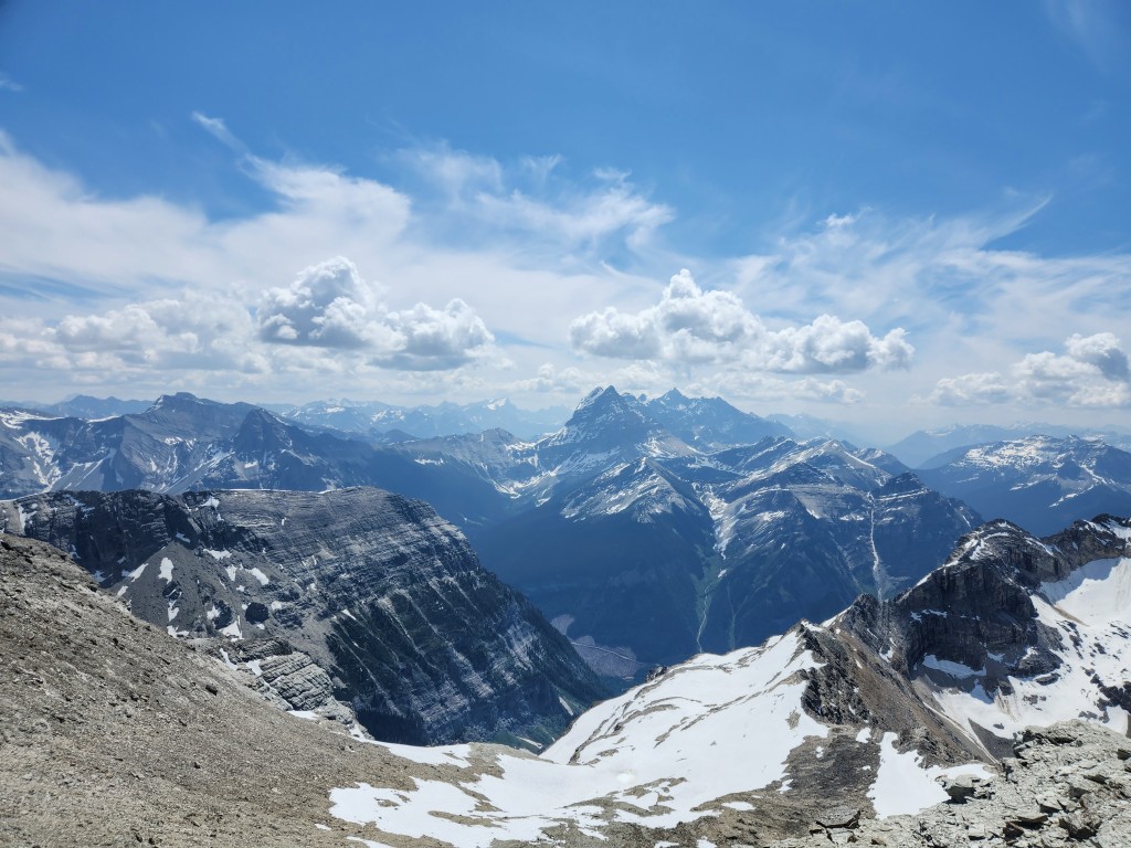
The snow ended before the gully turns a corner, so I scooted up to more solid terrain on the rib above on the right. The rib brought me to the west ridge and a stunning reveal of the mountains to the north. The summit block held some fun easy scrambling and soon I was at the summit!


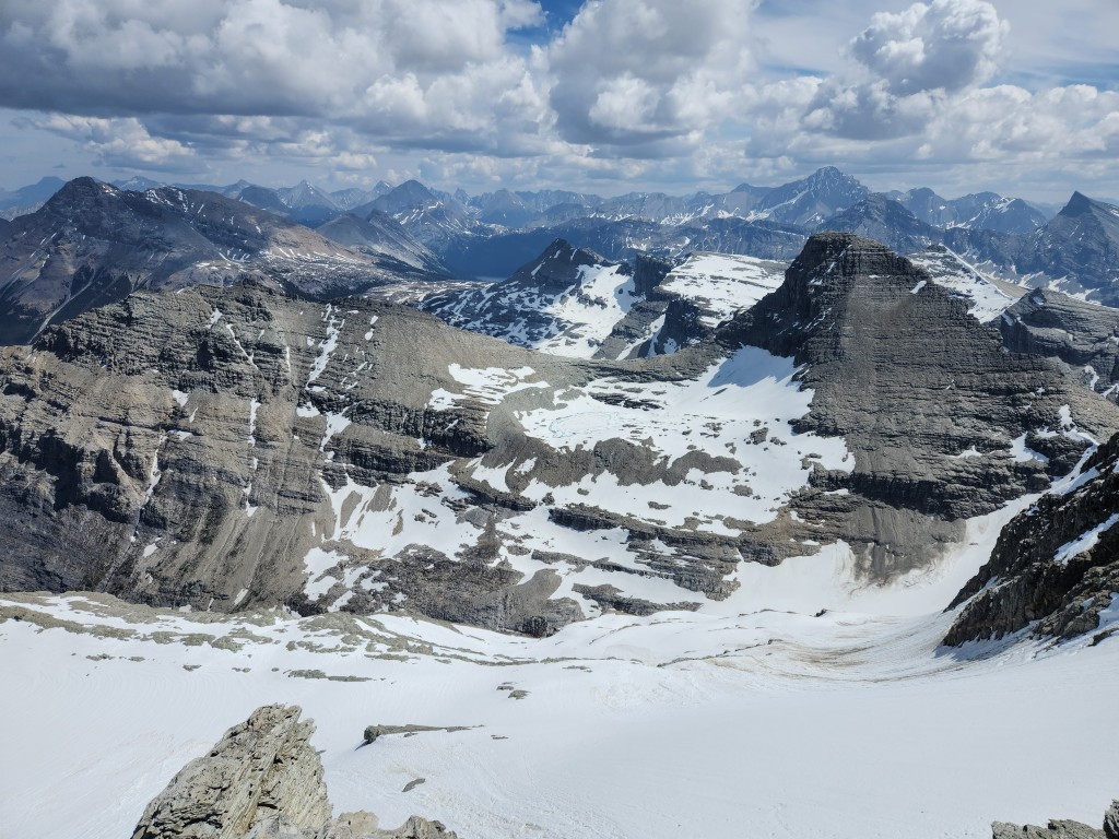
I enjoyed a 30-minute lunch break at the summit before following the siren call of the long snow descent awaiting me. I went straight down the gully from the ridge on fantastically loose scree and then plodded down some slower stuff before hitting the top of the snow slope. Short of actual skiing, boot-skiing has got to be one of the best ways to descend a mountain. Half an hour up, four minutes down! Some clouds rolled in as I made my way back to the car. It started to drizzle a bit, which got me worried about the drive out as the rough part of the road looked like it would be quite slippery if wet. Luckily, the rain never got too heavy and it stopped by the time I was back at the car. The drive out was delightfully uneventful and soon I was back at Nipika to hang out in the shade and enjoy snacks and drinks with the family.
This was a perfect short day trip. It would be a long drive from Calgary for just a day trip, but if you’re in the area then it’s definitely worth it! More than once, I marveled to myself that this was a ridiculously straight-forward scramble. Minimal bushwhacking, simple off-trail routefinding, easy scrambling, quick day, excellent views!
